 |
Skeptics dismiss Yonaguni
as just a natural rock formation,
but many see it as plain evidence
of an ancient seafaring culture
the lost civilization of Atlantis
This symmetrical design of a human face
4 meters tall and 6 meters underwater
and wearing a decorative head-dress
is carved deep into the natural stone
and faces due south as a sentinel for
a platform known as the stone stage
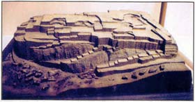
This is but one peak of a much larger
- and definitely man-made structure -
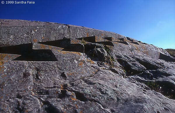
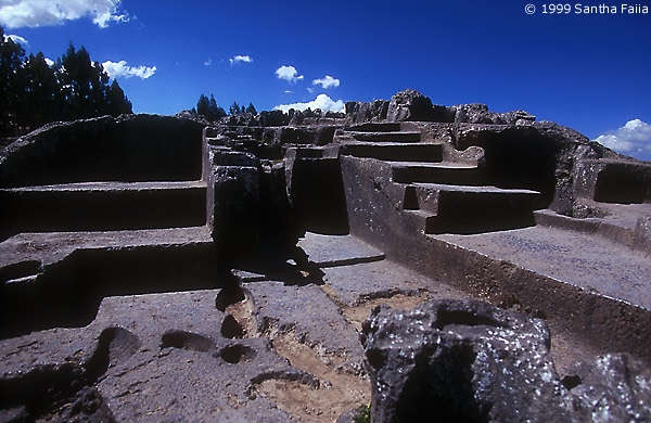
the architecture remarkably reminiscent
of Sacsayhuaman and Qenko in Peru
- but on the other side of the Pacific -
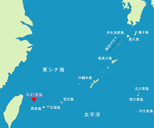
just 75 miles (125 km) east of Taiwan
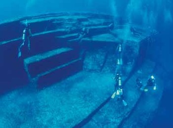
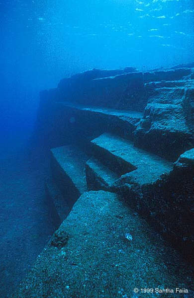
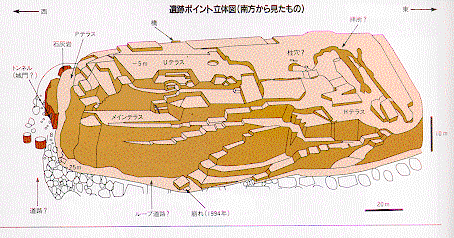
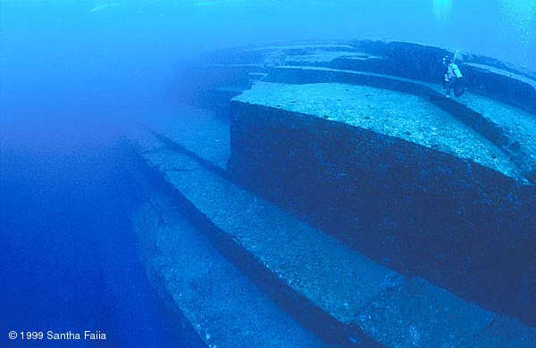
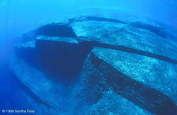
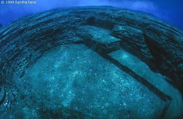
The structure is 120 meters long
- 40 meters wide and 20-25 meters tall -
- and the base is 30 meters underwater -
The many level and right-angled terraces
give a first impression of an ancient port
- with smaller steps for people to climb -
- and larger recesses for boats to dock -
and there are many features aligned to
- the four cardinal directions of NSEW -
The site has been
roughly dated as being
3,000 to 10,000 years old
as the most recent the
structure's foundation
was above sea level
was at the end of
the last Ice Age
around 8000 BC
Back then, the island was connected
to the Asian mainland via a land bridge
- along with Taiwan, Ryukyu and Japan -
and, due to Earth's cycle of precession
- the site was geographically located -
- right where the east coast of Asia -
intersected with the Tropic of Cancer
and thus, was astronomically aligned
- with the northern Summer Solstice -
|
|
|
 |
|
|
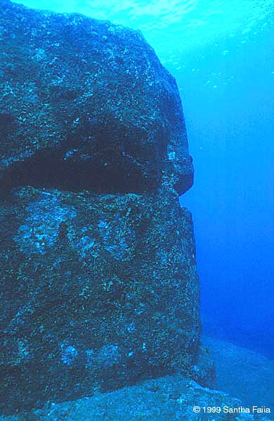
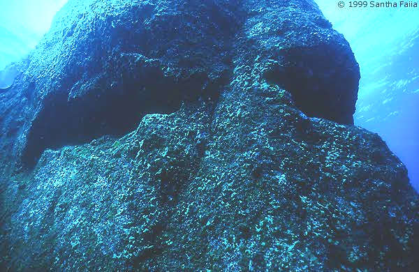
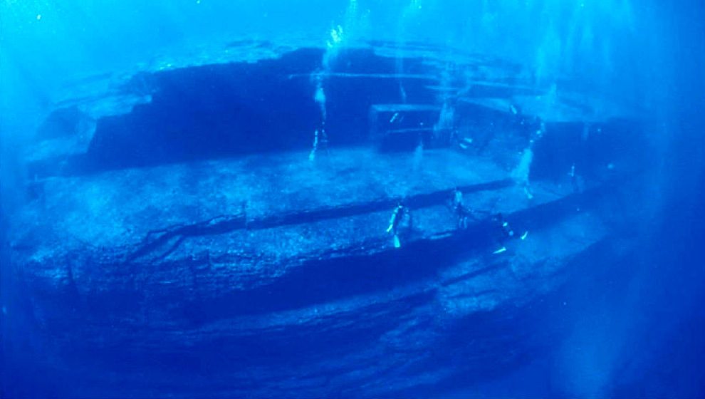
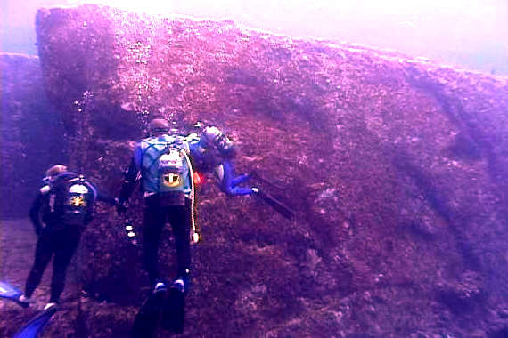
Now submerged beneath 18 metres of ocean,
could this underwater apparition off Yonaguni be
a much eroded megalithic carved head, left behind by some lost antediluvian culture?
Or is it just another one of the apparently limitless "freaks of nature"
that geologists wish to persuade us have somehow managed to accumulate
around one tiny island in the extreme south-west of Japan?
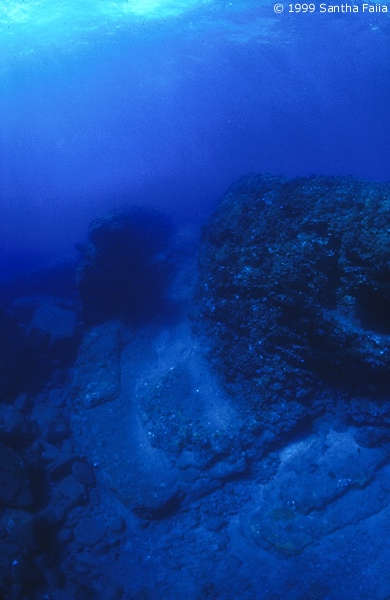
The "Face", as it is known to local divers, and the "Stone Stage" of which it is an integral part,
are located off the south coast of Yonaguni 2 kilometers to the east of the main monument.
| |
|
|
 |
 |
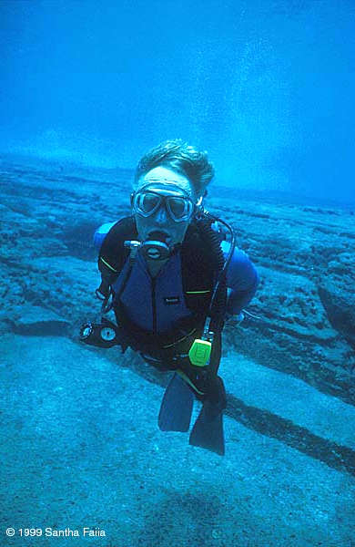
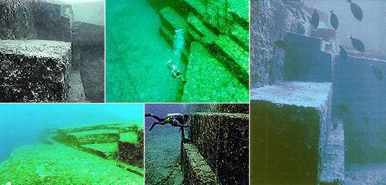
The Stone Head - right port-side profile, and platform: the eye sockets
are symmetrically reflective of each other
(rounded near the bridge, sharp points outside)
and each nearly two meters wide (right image: diver shows scale)
| |
|
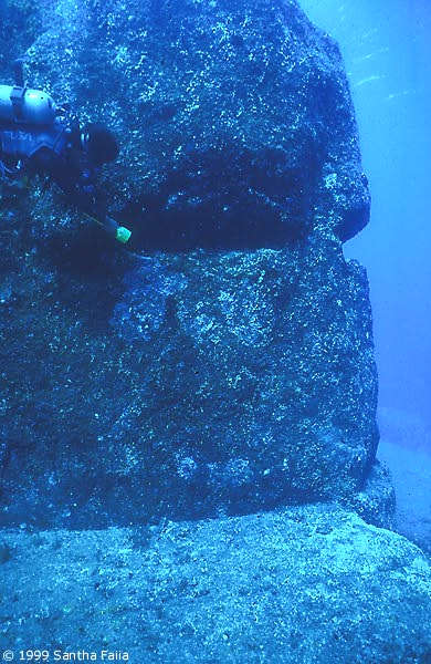
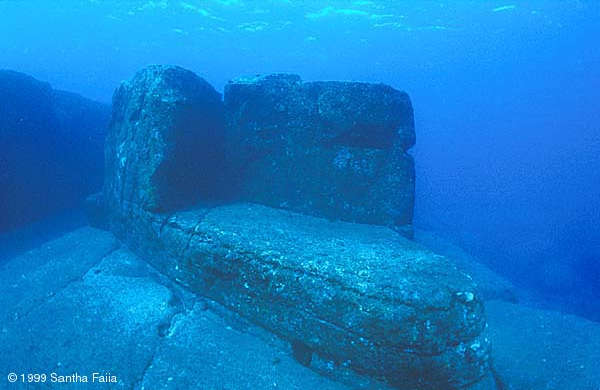
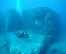
The Stone Stage
Near the southeast corner of the monument
is a pair of very curious features known as the Stone Face and the Stone Stage.
Facing due south, the eastern, sunrise, seaward side of the head has detail;
but assuming it had the function of a port marker,
no decorations would be needed, port-side.
|
|
 |
The Stone Face
It was probably not a temple. The Face is not an idol.
It's not a glorified or threatening image. It's not a skull.
It could be a god, but is probably more symbolic,
something like their more ancient version of Poseidon.
From the left profile, it almost looks a little like a turtle.
|
|
 |
Landmark
But it is instantly recognizable as a face: with two eyes, a nose and a mouth.
And, above water, would still look like a face from very far away
- universally understood: this is an outpost of Man
- or, perhaps a distinctive landmark,
probably a unique image denoting a specific port.
Sailors from distant shores might well have heard of this place,
and now they could be sure they were right where they wanted to be:
the platform's rounded corner pointing due south, towards the equator.
|
|
 |
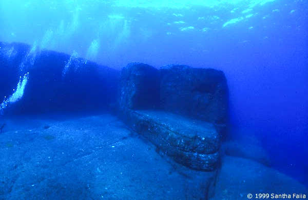
Lighthouse Beacon
The eyes of the Face are head high, approximately two meters above the platform.
By placing fire in the eye sockets, this signal might be seen from miles offshore
and easily blocked, for blinking signals
- with perhaps the level platform above the head, for larger fires
- and the Stage as a signaling platform, flagging ships to land.
The groove forming "the mouth" is at the same level as the platform
- possible footholds, perhaps just above the waterline at high tide.
The ramp in the foreground might have been
mostly submerged at high tide,
and mostly exposed at low tide.
|
|
|
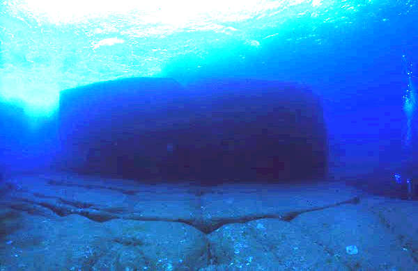 |
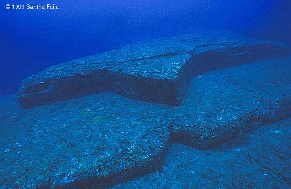
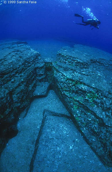
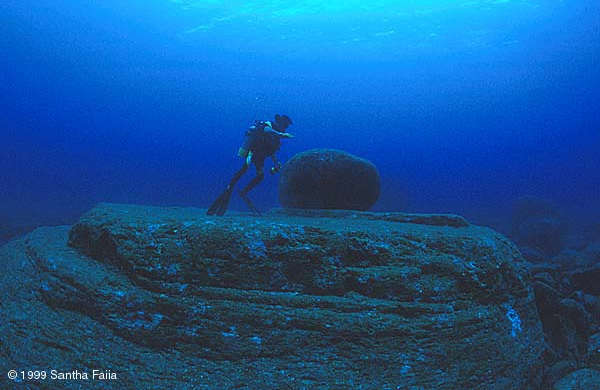
The Mesa - northern face of a giant (approximately 10x30 meter) rectangular platform
which rises between three and five meters above the surrounding floor of giant blocks
centered on the center line of the southern half, in the SW corner of the monument
(note the highly eroded right-angle joints between the blocks that make up the floor).
|
|
|
 |
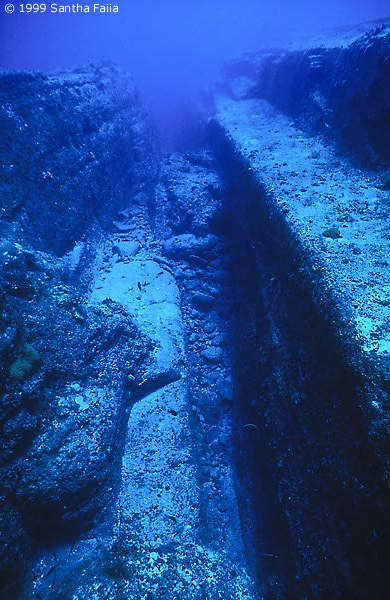
Post Holes - perhaps for mooring of small ancient ships:
of equal diameter and each nearly half a meter deep
- with slotted groove between them, for secure lines -
and triangular corner edge, ideal for wave deflection.
The same idea as modern marina pilings, today.
|
| |
|
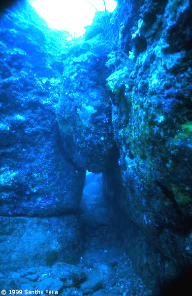 |
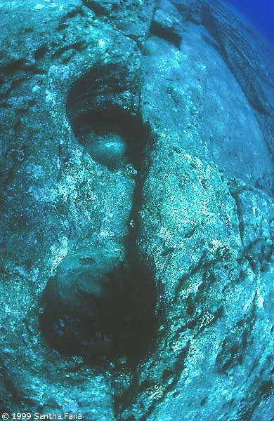
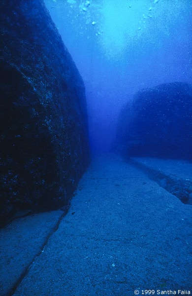
The Tunnel - where a large boulder seems to be wedged
(perhaps fallen into place, over millennia underwater)
is acting as a roof over an obviously man-made corridor
- note the groove between two large blocks on left wall
and on the right wall, at the same height above the floor.
|
| |
|
 |
Thunderbird - What could be the meaning of this particular, clearly not coincidental
arrangement and configuration of right angled corners and parallel platforms ?
|
| |
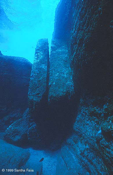
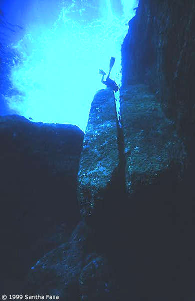
The Ramps - SW corner, a pair of 45� angle stone slabs, each 3 stories high (right image: diver shows scale)
could easily be a boat launch, with the groove or slot between them, as a guide for the keel of a small ship
| |
 |
 |
|
|
|
Terraces and steps: prehistoric rock-hewn structures at Sacsayhuaman (above)
and nearby Qenko (below) in the high Andes mountains of Peru.
|
|
|
|


